The design of structures and buildings must take into account extreme wind conditions.
The wind sizing of constructions is governed by Eurocode 1(1): “Actions on Structures,” and more specifically, the “Wind Actions” section.
It is supplemented by its National Annexes(2), which specify certain parameters specific to France.
The local wind speed depends on the location, height above ground level, terrain shape, and ground obstructions in its path. While the first two elements are easy to consider, roughness (type of obstacle) and orography (terrain shape) are much more challenging.
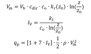
The roughness effect is easily modeled, but depends on a parameter z0 (Roughness length), which is very challenging to define precisely: the user must compare aerial photographs of the site with a roughness scale table categorized into five terrain types. It’s a delicate step, open to interpretation.
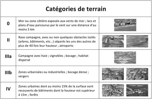
Extract from the French National Annex. The terrain categories may vary from one territory to another.
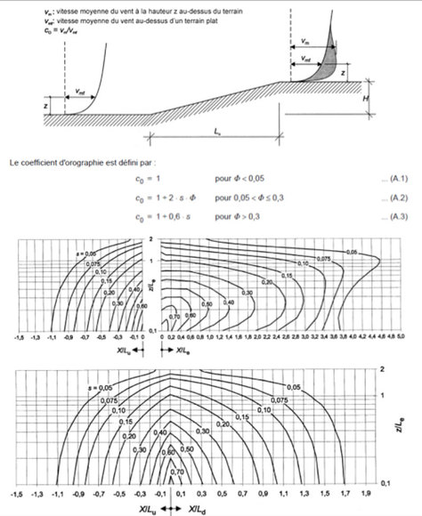
As for orography, the formulas proposed by the Eurocode are quite difficult to implement, especially since the shape of the ground is rarely known with precision! One would need to obtain elevation maps and calculate local slopes around the site to estimate the orography factor co.
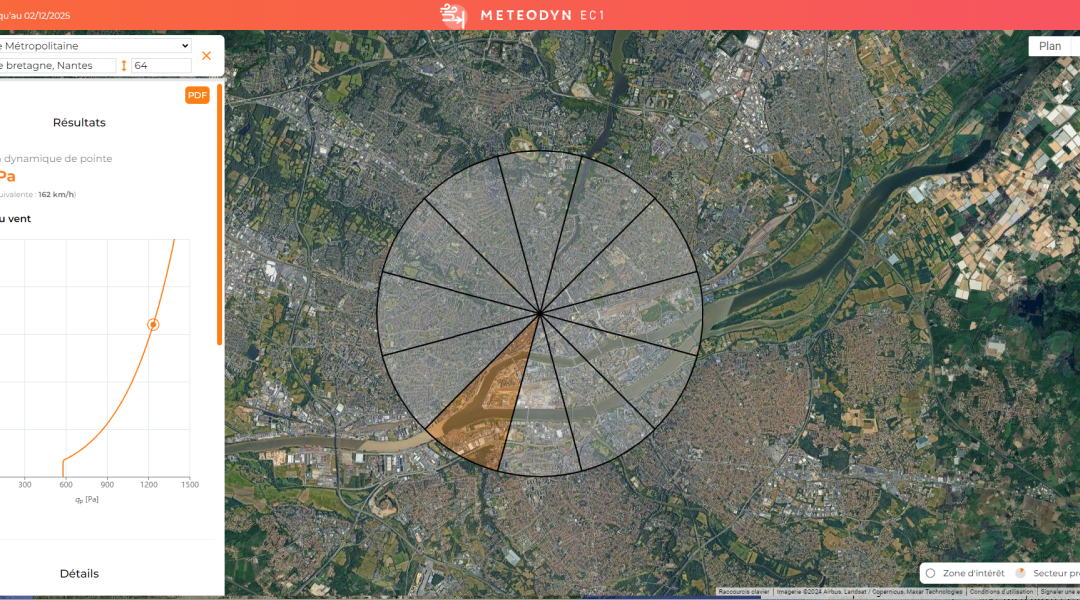
Meteodyn offers online application https://ec1.meteodyn.com which answers all these questions.
All you have to do is enter the location and height of the building, and the application takes care of the rest!
Regional parameters Vb and co are extracted from the maps in the National Annex (2) based on the geographic coordinates of the location. The application uses the CORINE Land Cover map provided by the European Copernicus program.
By assigning a specific roughness to each type of land use (compatible with the Eurocode scale) and using the statistical calculation of aerodynamic drag, the roughness z0 is deduced for each wind sector.
For the orographic coefficient, the French National Annex recommends Procedure 1 for the most commonly encountered types of orography (obstacles with varying heights and shapes):
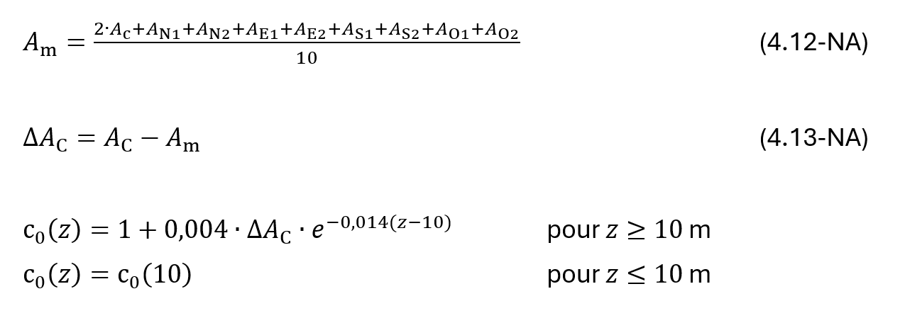
In the application, the orography values Ai are derived from public NASA data, specifically SRTM, with a spatial resolution of 3 arc seconds. This altimetric map enables the automatic calculation of the orographic coefficient co.
With the online application Meteodyn EC1, you have access to a fast and user-friendly tool that considers all the parameters influencing the reference wind speed, which determines the sizing of your structures.
Simply enter the location of your project by its address or GPS coordinates and the desired height. The application automatically determines the roughness and orography coefficients and then calculates the reference dynamic pressure to be used for sizing your structure.
3 Documents used during the design of the application
(1) Eurocode
- NF EN 1991-1-4 (Nov. 2005)
- NF EN 1991-1-4/A1 (Oct. 2010)
(2) French National Annex
- NF EN 1991-1-4/NA (March 2008)
- NF EN 1991-1-4/NA/A1 (July 2011)
- NF EN 1991-1-4/NA/A2 (Sept. 2012)
More advanced approaches are needed to refine the calculation and attempt to reduce the orography coefficient.
Meteodyn offers a Computational Fluid Dynamics (CFD) reference wind speed assessment service dedicated to wind computation in complex terrain.
It meets the need perfectly, taking into account the roughness and orography of the terrain.
It is compatible with the Eurocode and supports the restrictions of clause 1.5(2) of the French National Annex.